Photos: Mountaineering
More photos to come...
Click on each thumbnail to view the entire photo.
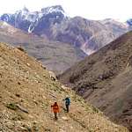 Narinder (l) and Jon (r) walk up the Tagne valley on a recce trip. Most of the route up the valley to ABC was like this: traversing steep, loose rock and dust, following intermittent tracks. The mountains of the Central Lahaul range can be seen in the background. Narinder (l) and Jon (r) walk up the Tagne valley on a recce trip. Most of the route up the valley to ABC was like this: traversing steep, loose rock and dust, following intermittent tracks. The mountains of the Central Lahaul range can be seen in the background.
photo © 2001 alan
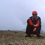 Alan, Dan, Steve, Jon & Andy (l-r) on the top of our (unnamed) acclimatisation peak (5100m). We called it "Cold Shoulder". It was probably another first ascent, but since it doesn't really count as a mountain (it's a subsidiary peak on the shoulder of a much higher mountain, a bit like the Petite Aiguille Verte), who cares? Alan, Dan, Steve, Jon & Andy (l-r) on the top of our (unnamed) acclimatisation peak (5100m). We called it "Cold Shoulder". It was probably another first ascent, but since it doesn't really count as a mountain (it's a subsidiary peak on the shoulder of a much higher mountain, a bit like the Petite Aiguille Verte), who cares?
photo © 2001 alan
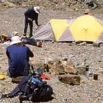 Narinder (l; not on thumbnail), Andy (c), Dan (r) and Jon (concealed by Andy's head) at ABC. One of the unclimbed peaks at the head of the Tagne valley peeps round the corner of an (unclimbed) enormous pile of choss masquerading as a mountain. Little bits of choss have been turned to a useful purpose in the foreground: forming a windshield for our stoves (and a home for little mice!) Narinder (l; not on thumbnail), Andy (c), Dan (r) and Jon (concealed by Andy's head) at ABC. One of the unclimbed peaks at the head of the Tagne valley peeps round the corner of an (unclimbed) enormous pile of choss masquerading as a mountain. Little bits of choss have been turned to a useful purpose in the foreground: forming a windshield for our stoves (and a home for little mice!)
photo © 2001 alan
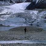 Steve strolls towards the lake at the foot of the North Tagne Glacier. This is an area of stunning beauty; concealed from below, it would be a worthy trekking destination in its own right (if the Chandra Tal's anything to go by!) Steve strolls towards the lake at the foot of the North Tagne Glacier. This is an area of stunning beauty; concealed from below, it would be a worthy trekking destination in its own right (if the Chandra Tal's anything to go by!)
photo © 2001 alan
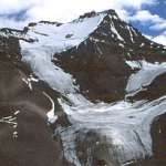 The South Face of Tagne, seen from the S. Tagne Glacier. This is the side from which the summit attempts were made. The South Face of Tagne, seen from the S. Tagne Glacier. This is the side from which the summit attempts were made.
photo © 2001 alan
click here for an annotated version of this picture (with route)
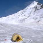 The E ridge and summit of Sagar (pt.6030), as seen from our Camp 1, halfway up the N. Sagar Glacier. Looks easy, doesn't it? (Is that another possible line up the middle of the face?) The E ridge and summit of Sagar (pt.6030), as seen from our Camp 1, halfway up the N. Sagar Glacier. Looks easy, doesn't it? (Is that another possible line up the middle of the face?)
photo © 2001 alan
click here for an inappropriate photomontage of this picture with one of Pt.6250
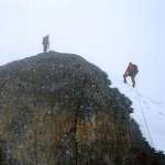 Success! Jon (l) and Steve (r) on the summit of Sagar after a ten-hour climb. As you can see, it was snowing. Success! Jon (l) and Steve (r) on the summit of Sagar after a ten-hour climb. As you can see, it was snowing.
photo © 2001 alan
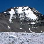 The SW face of Pt.6250. This is the highest mountain in the Lahaul & Spiti watershed range, and remains unclimbed. Any ascent from the Tagne valley would probably take more than one day, and involve climbing (perhaps technical climbing) on pretty much the worst rock you can imagine, if the rest of the region is anything to go by! Possibly a more practical prospect in a snowier season (or by helicopter). The SW face of Pt.6250. This is the highest mountain in the Lahaul & Spiti watershed range, and remains unclimbed. Any ascent from the Tagne valley would probably take more than one day, and involve climbing (perhaps technical climbing) on pretty much the worst rock you can imagine, if the rest of the region is anything to go by! Possibly a more practical prospect in a snowier season (or by helicopter).
photo © 2001 alan
click here for an annotated version of this picture (with choss)
click here for an inappropriate photomontage of this picture with one of Sagar (pt.6030)
|

